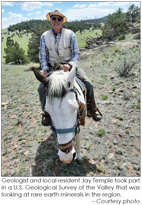
Geologist Jay Temple kept his audience interested and asking questions about rare earth minerals as he led them through a discussion of minerals analysis and geologic mapping in Custer and Fremont Counties during a presentation last month.
Temple is a field geologist and is working with the Colorado Geological Survey (CGS), a state agency situated within the Colorado School of Mines, on a two-county mapping project and examination of critical rare-earth minerals, which is jointly funded by the U.S. Geological Survey (USGS) and CGS.

The study includes aeromagnetic surveys, which passively measure subtle variations in the Earth’s magnetic field from the air, thus “aeromagnetic anomalies.” Differences in the magnetization of rocks from the surface to deep in the Earth cause aeromagnetic anomalies. You may have seen the helicopter flights over the Valley in 2021 when the USGS was flying tight grids over the Valley floor.
A primary task of the study is to create a regional geologic map of the Wet Mountains and the Wet Mountain Valley. Existing maps are all different scales and detail.
“We interpret geology from aeromagnetic anomalies and other geoscientific information. Our study is a partnership with the USGS and is focused on developing a modern geologic map of the area from Cañon City and south of Westcliffe between Highways 69 and 67. Rare earths were of little interest until the 1960s when scientists discovered their unique electromagnetic qualities,” Temple said. “Parts of these areas were mapped in the 1950s, 60s, and 70s but at different scales. We have to combine the maps at a consistent scale and remap areas where there may be problems. This mapping project also allows us to extrapolate into the subsurface to better understand the groundwater aquifer system,” he added.

By understanding the groundwater aquifer, geologists can tell developers and homeowners about subsurface water supplies. Much of the Wet Mountain Valley is granitic and well-fractured, so water supplies tend to be plentiful.
One of the indicators of rare earth minerals is thorium, which occurs in both counties. Thorium is used to make ceramics, welding rods, camera and telescope lenses, fire brick, heat-resistant paint, and metals used in the aerospace industry, as well as in nuclear reactions. Thorium has the potential to be used as a fuel for generating nuclear energy.
From the 1960s until the 1980s, the Mountain Pass rare earth mine in California made the United States the leading producer. Today, deposits in India and South Africa still produce some rare-earth concentrates, but they are dwarfed by the scale of Chinese production. In 2017, China produced 81% of the world’s rare-earth supply, mostly in Inner Mongolia, although it had only 36.7% of the reserves. Some outside China are concerned that because rare-earths are essential to some high-tech, renewable-energy, and defense-related technologies, the world should not be so reliant on a single supplier country.

Extraction of rare earths is problematic for the number of steps it takes and the environmental hazards (thorium concentrations are radioactive). In Temple’s estimation, there isn’t a direct relation to thorium here. “We examined over 400 veins with some concentrations, but they are probably not mineable in Custer County,” he explained.
Temple also said that money is not available internationally for research on thorium. It does not have the energy release of uranium, but it is the most plentiful. Scientists still need more information on the mineral.
Temple conducts geology lectures and walks in the Garden of the Gods, and said some of the most spectacular geology in the area is Temple Canyon near Cañon City. He offered to take people on hikes in the canyon and said that possibly the West Custer County Library could coordinate the hikes in the future.
– Ellen Glover


